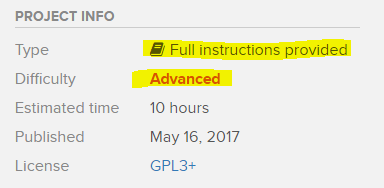
I put this on the arduino fourm but they said its more a blynk thing so here i am XP
I’m using an Arduino Mega with a GPS UBLOX NEO-7N Satellite Positioning Module For Arduino 51MCU STM32
and I’m trying to follow
but it won’t follow me, and if I set coordinates the serial monitor shows-
Received Text: 123, 456
Waypoint found: 123.00456.00
Reading onboard GPS:
But it doesn’t set anything for the “onboard GPS” section.
The GPS as via the instructions is connected to pin 7
The code is the exact same as the hackster link [execpt the char auth[]'s code]
Since this is a Hackster project… have you asked for help over there?
We will try to help you learn how Blynk works… but the key there is “you learn” ![]() We are not going to sift through someone else’s project and figure it out for you
We are not going to sift through someone else’s project and figure it out for you ![]()
Start by breaking the code down until you understand the “hows and whys” of it’s operation… then you might have a better chance at asking relevant questions here.
Yeah, my goal is to learn why or what is causing this issue and how to fix things such as this later :light_smile:
What is your skill level?.. this thing is a bit much for a beginner

Lots of Blynk documentation and examples available with the Links at the top of this screen.
Dig in, and have fun 
I’m new to blynk but I’ve done a bit of Arduino when I can, I’ve got the circuit up and running and I’ve done a working app with it (using blynk, h-bridge, and joystick)
With following
(and yes i have attempted to contact the project owners and asked in the comments of the post)
I’ve succeeded in creating the circuit. But I need help with the GPS output.
when I send it “a text” through the blynk app it shows up on the serial monitor as-
Received Text: 746, 5
Waypoint found: 746.005.00
Reading onboard GPS:
But the onboard GPS never sets anything.
the GPS light is blinking [which means its got a fix]
If I plug the GPS TX pin into pin 1 and set the #define GPS_TX_PIN to 1 it gives me the raw GPS data over the serial monitor which is correct if I enter it into google maps. and on u-center, it says its connected to about 7 GPS’s.
But I can’t figure out why the GPS won’t feed this information through.
Any help is appreciated
Thanks
Please do not create multiple topics for same issue. I have merged both into your original.
I have same problem with you working on this follow me project.The problem is when use gps module with blynk maybe the communication between arduino and gps was lost.
This is gps test code when not connecting to blynk and it’s work.
// Imports
#include <SoftwareSerial.h>
#include "TinyGPS1.h"

SoftwareSerial serial_connection(8,12);

TinyGPSPlus gps;//This is the GPS object that will pretty much do all the grunt work with the NMEA data

void setup()
{
  Serial.begin(9600);//This opens up communications to the Serial monitor in the Arduino IDE
  serial_connection.begin(9600);//This opens up communications to the GPS
  //Blynk.begin(bluetoothSerial, auth);

  Serial.println("GPS Start");//Just show to the monitor that the sketch has started
}

void loop()
{
  serial_connection.listen();
  while(serial_connection.available())//While there are characters to come from the GPS
  {
    gps.encode(serial_connection.read());//This feeds the serial NMEA data into the library one char at a time
  }
  if(gps.location.isUpdated())//This will pretty much be fired all the time anyway but will at least reduce it to only after a package of NMEA data comes in
  {
    //Get the latest info from the gps object which it derived from the data sent by the GPS unit
    Serial.println("Satellite Count:");
    Serial.println(gps.satellites.value());
    Serial.println("Latitude:");
    Serial.println(gps.location.lat(), 6);
    Serial.println("Longitude:");
    Serial.println(gps.location.lng(), 6);
  }

}
then when working with blynk the code is
#define BLYNK_USE_DIRECT_CONNECT
// Imports
#include <math.h>
#include <Wire.h>
#include <SoftwareSerial.h>
#include <BlynkSimpleSerialBLE.h>
#define BLYNK_PRINT Serial
#include <SPI.h>
#include <Ethernet.h>
#include <MechaQMC5883.h>
#include "TinyGPS1.h"

SoftwareSerial serial_connection(8,12);
SoftwareSerial bluetoothSerial(2,3);

TinyGPSPlus gps;//This is the GPS object that will pretty much do all the grunt work with the NMEA data
char auth[] = "0be6dbefa3714df8949255b20d98139e";
int a=0;

BLYNK_WRITE(V0) {
  gpsza();
}

void setup()
{
  Serial.begin(9600);//This opens up communications to the Serial monitor in the Arduino IDE
  serial_connection.begin(9600);//This opens up communications to the GPS
  bluetoothSerial.begin(9600);
  Blynk.begin(bluetoothSerial, auth);
  Serial.println("GPS Start");//Just show to the monitor that the sketch has started
}

void loop()
{
  Blynk.run();
}

void gpsza(){
  serial_connection.listen();
  while(serial_connection.available())//While there are characters to come from the GPS
  {
    gps.encode(serial_connection.read());//This feeds the serial NMEA data into the library one char at a time
  }
  if(gps.location.isUpdated())//This will pretty much be fired all the time anyway but will at least reduce it to only after a package of NMEA data comes in
  {
    //Get the latest info from the gps object which it derived from the data sent by the GPS unit
    Serial.println("Satellite Count:");
    Serial.println(gps.satellites.value());
    Serial.println("Latitude:");
    Serial.println(gps.location.lat(), 6);
    Serial.println("Longitude:");
    Serial.println(gps.location.lng(), 6);
  }
  bluetoothSerial.listen();
}
help me please thank you