For updating maps (both mobile and web), which method should we use? i.e
Blynk.virtualWrite(V1, LNG, LAT);
or
WidgetMap myMap(V1); myMap.location(1, LAT, LNG, "Beehive1");
How do we update the “IP LAT/LON” on the Device Info page? For me it shows an incorrect location on the web dashboard and “No Value” on the Android app.
method is for legacy compatibility, although it does have more functionality than the new method.
I think those coordinates come from doing an IP location lookup, and will be based on data from your ISP - which will often be the location of their regional office …
Try pasting your public IP address into a service like this:
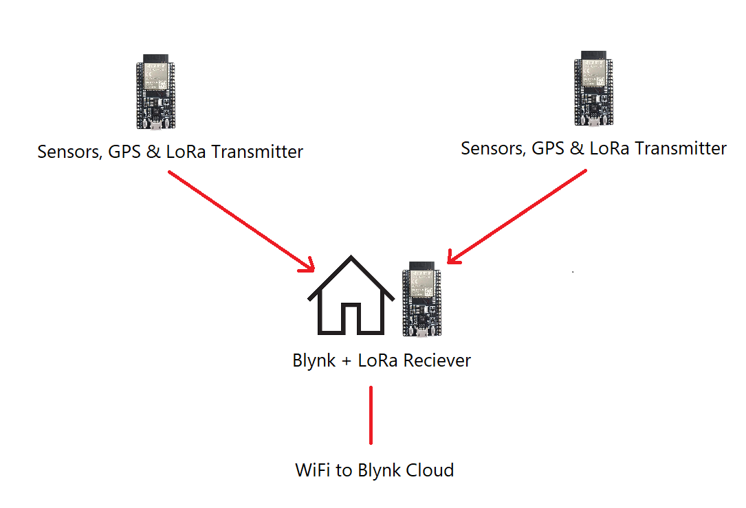
I have a few beehives sending data to a WiFi connected esp32 running blynk, which then sends values up from each hive that’s transmitting via LoRa.
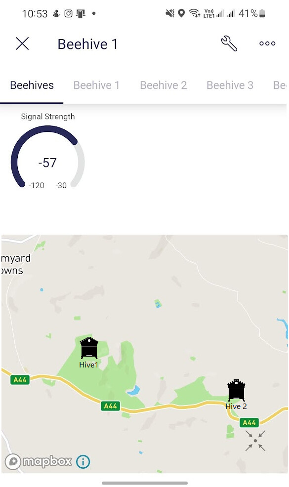
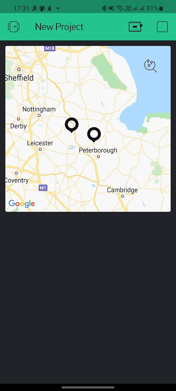
I want to show the location of each hive on the map, my original plan was a map per tab/hive but I see only a single map is allowed. Is it possible to add labels or custom location marker icons in an update to allow and differentiate multiple GPS coordinates on a single map?
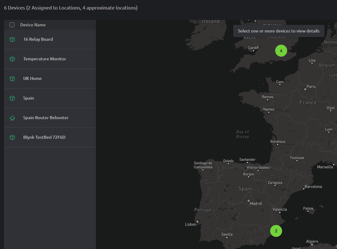
Go to Settings > Locations and add a number of different locations. You can fine-tune the exact spot by dragging the pointer on the map.
Go to your Template, Metadata tab and Edit. You should have an entry of type “Location”, edit this to enable location and type something in the location field - I’d recommend simply “Location”, as this doesn’t seem to do anything as far as the rest of the process is concerned. Then turn on the “Editable by End Users” option and save/apply the changes
The go to Devices (the spyglass icon) select your device then go to the Metadata tab. You should see a “Location” entry. Hover over this and you’ll see an Edit icon. This then pops-up a Choose Location drop-down menu where you can pick the previously created location.
There’s also a “Create New Location” button, which you could use instead of the Settings > Locations option.
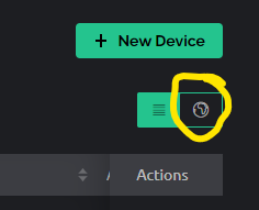
When you’re in the Device (Spyglass) view you have this globe icon…
If you are OK with a static map, you can use an image button pointing to a google map api URL.
You can add location markers, etc. link
You could also dynamically create the URL using: Blynk.setProperty(V1, "url", 1, "https://.....");
You would need to sign up and get an API key though. A certain number of API calls are apparently free.
Hi @chinswain, my app is using Map and labels successfully like this. I can also dynamically change the color of the marker using a var for the last argument in the call.
sprintf(pmLabel, "PM2.5:%4dug/m3\n", dustvalues1.PM2_5Val_atm); // use PM2.5 value for marker label

 Blynk.virtualWrite(V5, markerNum, latID, lonID, pmLabel, newColor); // update marker position=GPS, color=PMAQI (marker color hack for iOS)
@Dmytro I would like to second this request. I am migrating from Blynk legacy to Blynk 2.0 and I have the same problem. Could you add multiple location (With label) functionality similar to legacy Blynk to Blynk 2.0?